
Greenside Row from Royal Terrace
Introduction
The photograph on this page of Greenside Row from Royal Terrace by kim traynor as part of the Geograph project.
The Geograph project started in 2005 with the aim of publishing, organising and preserving representative images for every square kilometre of Great Britain, Ireland and the Isle of Man.

There are currently over 7.5m images from over 14,400 individuals and you can help contribute to the project by visiting https://www.geograph.org.uk
Greenside Row from Royal Terrace
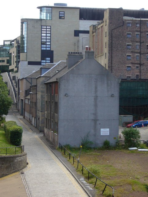
Image: © kim traynor Taken: 2 Jul 2010
The last remaining buildings of what was once a densely-packed community in Greenside before slum clearance began in the 1960s. Their days now seem numbered as year after year modern buildings creep down the slope from Leith Street and encroach upon them. The open ground was occupied by the tenement at Marshall's Court in which an infamous double child-murder took place in 1953.
Images are licensed for reuse under creativecommons.org/licenses/by-sa/2.0
Image Location

Latitude
55.956475
Longitude
-3.184028