Erosion
Introduction
The photograph on this page of Erosion by Anne Burgess as part of the Geograph project.
The Geograph project started in 2005 with the aim of publishing, organising and preserving representative images for every square kilometre of Great Britain, Ireland and the Isle of Man.

There are currently over 7.5m images from over 14,400 individuals and you can help contribute to the project by visiting https://www.geograph.org.uk
Erosion
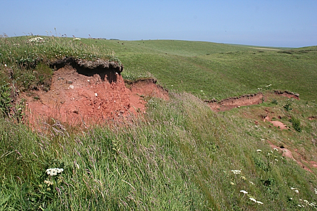
Image: © Anne Burgess Taken: 2 Jul 2010
The land here is blanketed with till deposited by glaciers during the last Ice Age. Here the rudimentary path exploits the scar left by a fault which has developed in the poorly consolidated till, exposing bare red earth.
Images are licensed for reuse under creativecommons.org/licenses/by-sa/2.0
Image Location
Latitude
57.366377
Longitude
-1.910211