Landwade Hall
Introduction
The photograph on this page of Landwade Hall by Bob Jones as part of the Geograph project.
The Geograph project started in 2005 with the aim of publishing, organising and preserving representative images for every square kilometre of Great Britain, Ireland and the Isle of Man.

There are currently over 7.5m images from over 14,400 individuals and you can help contribute to the project by visiting https://www.geograph.org.uk
Landwade Hall
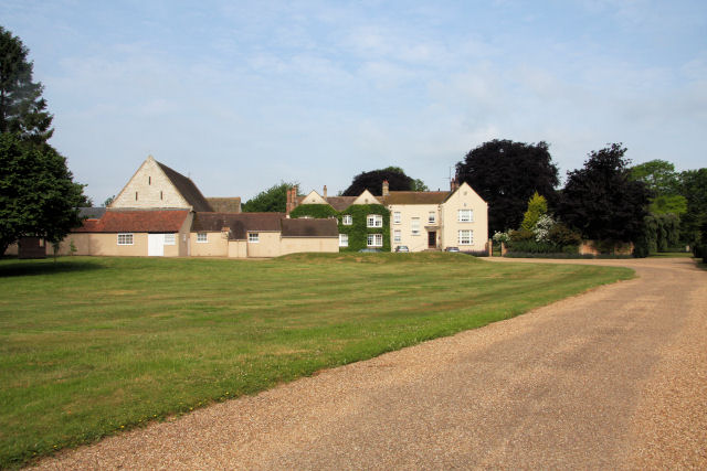
Image: © Bob Jones Taken: 30 Jun 2010
The present hall replaced the former moated hall which was demolished in the early part of the 20th century after lying derelict for many years. The present house incorporates a 17th-century stone house, with mullioned and transomed windows. Further extensions to the hall were added in the 18th and 19th centuries.
Images are licensed for reuse under creativecommons.org/licenses/by-sa/2.0
Image Location
Latitude
52.285616
Longitude
0.378879