Burnley (Central) Station
Introduction
The photograph on this page of Burnley (Central) Station by Ben Brooksbank as part of the Geograph project.
The Geograph project started in 2005 with the aim of publishing, organising and preserving representative images for every square kilometre of Great Britain, Ireland and the Isle of Man.

There are currently over 7.5m images from over 14,400 individuals and you can help contribute to the project by visiting https://www.geograph.org.uk
Burnley (Central) Station
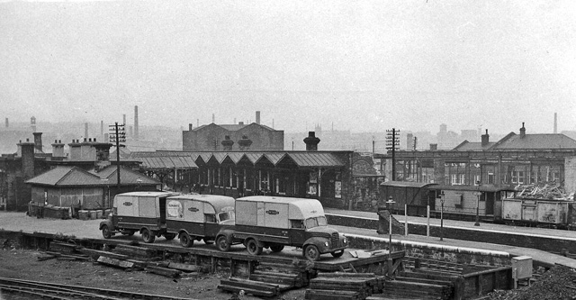
Image: © Ben Brooksbank Taken: 22 Sep 1962
View westward, towards Burnley Barracks and Accrington (to left); ex-Lancashire & Yorkshire main line, Preston/Manchester - Blackburn - Accrington - Burnley - Colne, called Bank Top until 10/44. The photograph was taken from a footbridge from Colne Road over the exchange sidings for traffic from the NCB Bank Hall colliery.
Images are licensed for reuse under creativecommons.org/licenses/by-sa/2.0
Image Location
Latitude
53.793961
Longitude
-2.24467