Site of Burnbank Station
Introduction
The photograph on this page of Site of Burnbank Station by Ben Brooksbank as part of the Geograph project.
The Geograph project started in 2005 with the aim of publishing, organising and preserving representative images for every square kilometre of Great Britain, Ireland and the Isle of Man.

There are currently over 7.5m images from over 14,400 individuals and you can help contribute to the project by visiting https://www.geograph.org.uk
Site of Burnbank Station
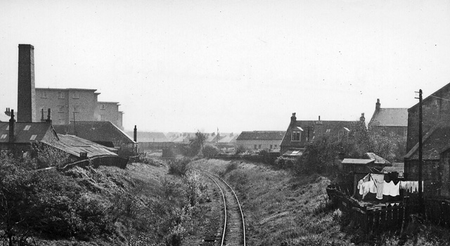
Image: © Ben Brooksbank Taken: 6 Oct 1961
View southward, towards Hamilton; ex-North British, Glasgow (Queen St. Low Level) - Shettleston - Hamilton line. The station was closed 15/9/52, when the service through to Hamilton ceased, but evidently goods traffic was still passing here in 1961.
Images are licensed for reuse under creativecommons.org/licenses/by-sa/2.0
Image Location
Latitude
55.784387
Longitude
-4.07344