Old signpost on Jones's Lane (2)
Introduction
The photograph on this page of Old signpost on Jones's Lane (2) by Stephen Craven as part of the Geograph project.
The Geograph project started in 2005 with the aim of publishing, organising and preserving representative images for every square kilometre of Great Britain, Ireland and the Isle of Man.

There are currently over 7.5m images from over 14,400 individuals and you can help contribute to the project by visiting https://www.geograph.org.uk
Old signpost on Jones's Lane (2)
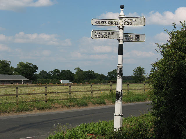
Image: © Stephen Craven Taken: 27 Jun 2010
This post is at the junction of Jones's Lane and Brereton Lane. It points towards Holmes Chapel, Sproston Green and Middlewich in one direction, Bradwell Green [sic] and Brereton Green in another, and Hollinsgreen and Sandbach in the third.
Images are licensed for reuse under creativecommons.org/licenses/by-sa/2.0
Image Location
Latitude
53.186118
Longitude
-2.394882