East Auchavaich
Introduction
The photograph on this page of East Auchavaich by Anne Burgess as part of the Geograph project.
The Geograph project started in 2005 with the aim of publishing, organising and preserving representative images for every square kilometre of Great Britain, Ireland and the Isle of Man.

There are currently over 7.5m images from over 14,400 individuals and you can help contribute to the project by visiting https://www.geograph.org.uk
East Auchavaich
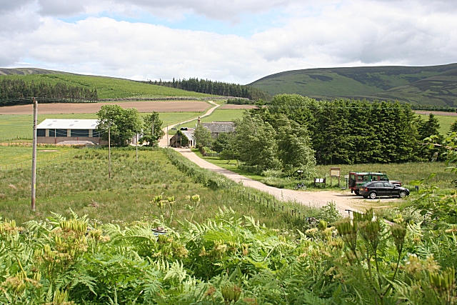
Image: © Anne Burgess Taken: 28 Jun 2010
To the right, at the start of the farm road, is a small car park, one of many provided by Glenlivet Estate to give walkers access to the extensive network of paths. The information board describes three walking routes based on tracks used in the days of illicit distilling to smuggle whisky out of these remote parts.
Images are licensed for reuse under creativecommons.org/licenses/by-sa/2.0
Image Location
Latitude
57.272644
Longitude
-3.255648