Site of Bulwell Forest Station
Introduction
The photograph on this page of Site of Bulwell Forest Station by Ben Brooksbank as part of the Geograph project.
The Geograph project started in 2005 with the aim of publishing, organising and preserving representative images for every square kilometre of Great Britain, Ireland and the Isle of Man.

There are currently over 7.5m images from over 14,400 individuals and you can help contribute to the project by visiting https://www.geograph.org.uk
Site of Bulwell Forest Station
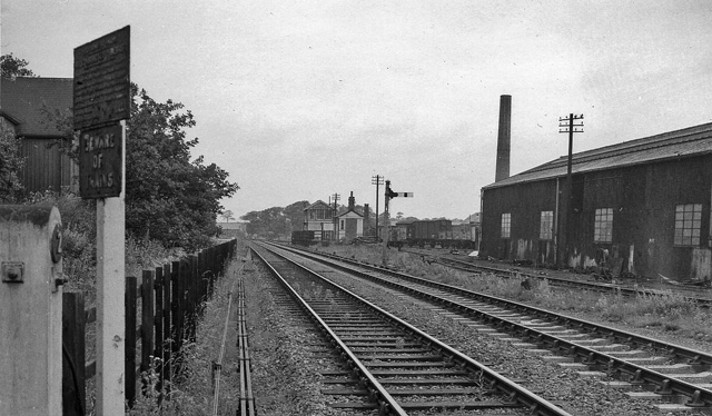
Image: © Ben Brooksbank Taken: 12 Jul 1963
View northward, towards Newstead and Shirebrook; ex-Great Northern Leen Valley line, Nottingham (Victoria) - Newstead - Shirebrook. The station was closed to passengers on 23/9/29 (along the route on 14/9/31), but goods continued here until 7/4/58 and to run on the route until about 1968.
Images are licensed for reuse under creativecommons.org/licenses/by-sa/2.0
Image Location
Latitude
53.002912
Longitude
-1.180375