Chantry House, Heptonstall
Introduction
The photograph on this page of Chantry House, Heptonstall by Humphrey Bolton as part of the Geograph project.
The Geograph project started in 2005 with the aim of publishing, organising and preserving representative images for every square kilometre of Great Britain, Ireland and the Isle of Man.

There are currently over 7.5m images from over 14,400 individuals and you can help contribute to the project by visiting https://www.geograph.org.uk
Chantry House, Heptonstall
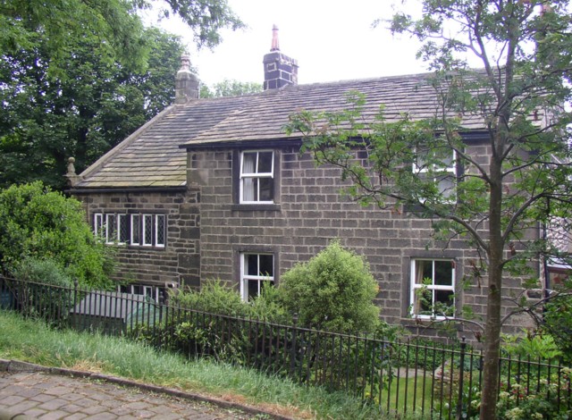
Image: © Humphrey Bolton Taken: 25 Jun 2006
This was once four weaver's cottages. Part at least of the upper floor has been used as a charnel house where bones of the dead were stored after being removed from the churchyard to make room for new burials. No wonder that a ghost was seen during conversion and renovation work in 1960!
Images are licensed for reuse under creativecommons.org/licenses/by-sa/2.0
Image Location
Latitude
53.74837
Longitude
-2.021192