Dunsfold Church
Introduction
The photograph on this page of Dunsfold Church by Colin Smith as part of the Geograph project.
The Geograph project started in 2005 with the aim of publishing, organising and preserving representative images for every square kilometre of Great Britain, Ireland and the Isle of Man.

There are currently over 7.5m images from over 14,400 individuals and you can help contribute to the project by visiting https://www.geograph.org.uk
Dunsfold Church
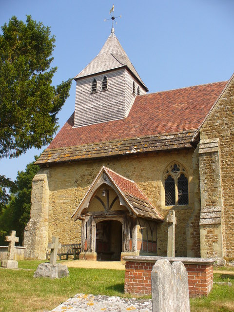
Image: © Colin Smith Taken: 26 Jun 2010
The parish church is about 1 mile west of the modern village. St Mary and All Saints is Norman (13th century) and built of Bargate stone, a local sandstone. The porch is medieval too and still has some old Horsham slabs (stone) on its roof. http://www.dunsfold.org/index.html
Images are licensed for reuse under creativecommons.org/licenses/by-sa/2.0
Image Location


Leaflet Map data © OpenStreetMap
Latitude
51.117403
Longitude
-0.575948