Water Tower
Introduction
The photograph on this page of Water Tower by Des Blenkinsopp as part of the Geograph project.
The Geograph project started in 2005 with the aim of publishing, organising and preserving representative images for every square kilometre of Great Britain, Ireland and the Isle of Man.

There are currently over 7.5m images from over 14,400 individuals and you can help contribute to the project by visiting https://www.geograph.org.uk
Water Tower
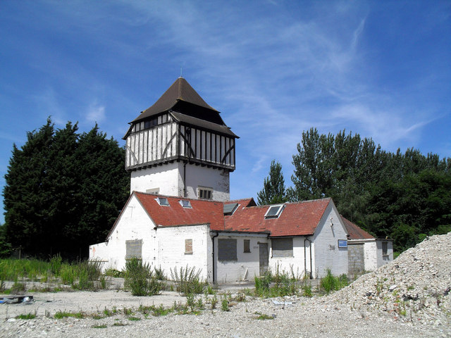
Image: © Des Blenkinsopp Taken: 21 Jun 2010
This water tower now stands in isolation in the north west corner of a former research centre site. All the buildings shown to the south on the map have been demolished as far as the central drive and the site is currently (June 2010) just heaps of rubble. I guess this tower counts as a building of interest so has been spared.
Images are licensed for reuse under creativecommons.org/licenses/by-sa/2.0
Image Location


Leaflet Map data © OpenStreetMap
Latitude
51.611702
Longitude
-1.316722