Railway path at Halton Lea Gate
Introduction
The photograph on this page of Railway path at Halton Lea Gate by Oliver Dixon as part of the Geograph project.
The Geograph project started in 2005 with the aim of publishing, organising and preserving representative images for every square kilometre of Great Britain, Ireland and the Isle of Man.

There are currently over 7.5m images from over 14,400 individuals and you can help contribute to the project by visiting https://www.geograph.org.uk
Railway path at Halton Lea Gate
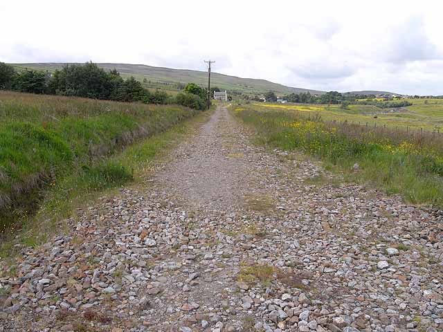
Image: © Oliver Dixon Taken: 24 Jun 2010
This section of "Lord Carlisle's Railway" from Brampton to Lambley dates from 1824 and served the coal mines in the area; it was closed in 1953. This stretch of the line has been upgraded to make a good path for walkers and cyclists. It offers cyclists the opportunity to ride for over 4 km from Halton Lea Gate to Tindale away from the A689 and although inadequately signed (there is no signage at this point where it meets a road) has been designated as "National Cycle Route 72". All quite misleading - the path is not connected at either end to signed cycle routes, nor does it make any connection with the main strand of Route 72 (Hadrian's Cycleway) some 7 km to the north.
Images are licensed for reuse under creativecommons.org/licenses/by-sa/2.0
Image Location
Latitude
54.92075
Longitude
-2.531514