Grassland west of Creek Farm
Introduction
The photograph on this page of Grassland west of Creek Farm by Robin Stott as part of the Geograph project.
The Geograph project started in 2005 with the aim of publishing, organising and preserving representative images for every square kilometre of Great Britain, Ireland and the Isle of Man.

There are currently over 7.5m images from over 14,400 individuals and you can help contribute to the project by visiting https://www.geograph.org.uk
Grassland west of Creek Farm
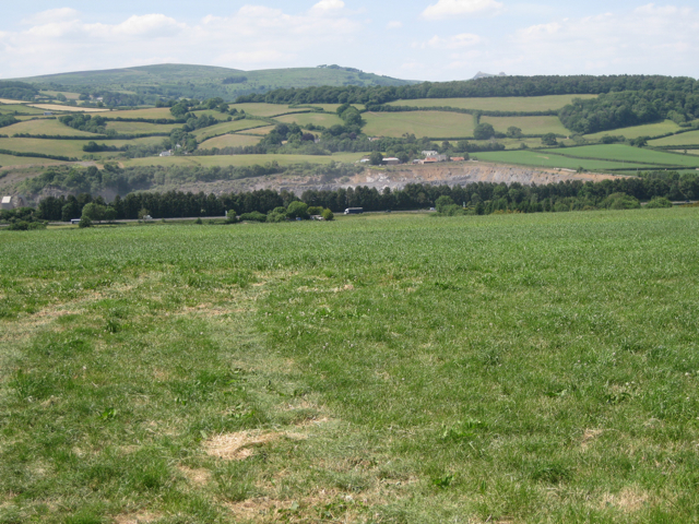
Image: © Robin Stott Taken: 22 Jun 2010
In the valley is the A38 northeast of Ashburton. A line of trees screens it from the huge Linhay Hill Quarry, whence dust is rising. Near the lip of the quarry is the settlement called Lower Waye Image On the skyline South Dartmoor presents, left to right (unless I am mistaken!), Buckland Beacon; nearer the camera, the south end of Halshanger Common with a disused rifle butts on top; and just visible to the right are the twin peaks of Haytor.
Images are licensed for reuse under creativecommons.org/licenses/by-sa/2.0
Image Location
Latitude
50.520021
Longitude
-3.727103