Sacred Trinity Church
Introduction
The photograph on this page of Sacred Trinity Church by David Dixon as part of the Geograph project.
The Geograph project started in 2005 with the aim of publishing, organising and preserving representative images for every square kilometre of Great Britain, Ireland and the Isle of Man.

There are currently over 7.5m images from over 14,400 individuals and you can help contribute to the project by visiting https://www.geograph.org.uk
Sacred Trinity Church
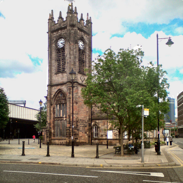
Image: © David Dixon Taken: 24 Jun 2010
Sacred Trinity is on the junction of Chapel St and Blackfriars Rd, very close to Manchester City Centre. Sacred Trinity church was originally built as a chapel-of-ease to serve the growing population of Salford in 1635. Most of the current building dates from 1752. It is a Grade II* listed building (List Entry Number:1386185 https://historicengland.org.uk/listing/the-list/list-entry/1386185 Historic England) with many original features. It was restored in 1877-74 and adapted for more flexible use in the 1980s. Sir Humphrey Booth raised the money for the original church. His grandson, also Humphrey Booth, set up a trust to maintain the church and help the ‘poor of Salford’. http://www.salfordchurch.org/Sacred_Trinity.html
Images are licensed for reuse under creativecommons.org/licenses/by-sa/2.0
Image Location
Latitude
53.484789
Longitude
-2.250601