Riverside walkway
Introduction
The photograph on this page of Riverside walkway by Lairich Rig as part of the Geograph project.
The Geograph project started in 2005 with the aim of publishing, organising and preserving representative images for every square kilometre of Great Britain, Ireland and the Isle of Man.

There are currently over 7.5m images from over 14,400 individuals and you can help contribute to the project by visiting https://www.geograph.org.uk
Riverside walkway
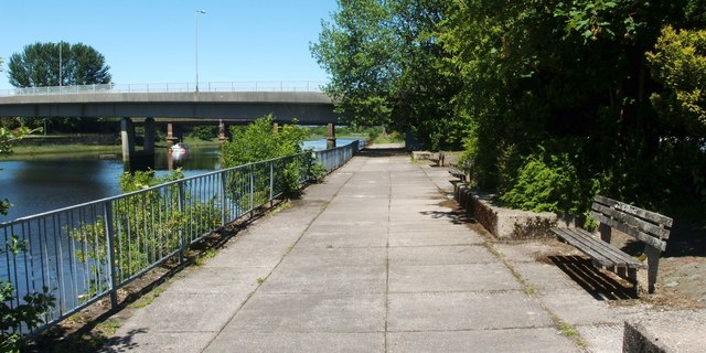
Image: © Lairich Rig Taken: 17 Jun 2010
This is a view along part of a footpath that leads along the eastern bank of the River Leven; it leads north to Kilmalid, at which point, after passing through a Image, the path leads away from the river. The present photograph was taken at the southern end of the route, where it begins beside some government offices, as shown in Image The nearer of the bridges in the background is Image See Image for a similar view, but taken from a point just beyond that bridge. This area is part of a quayside that served a glassworks. Only a few of the original cobbles can be seen here, behind the benches, but more are visible just to the south: Image
Images are licensed for reuse under creativecommons.org/licenses/by-sa/2.0
Image Location
Latitude
55.945865
Longitude
-4.574556