Bryn Teify Station
Introduction
The photograph on this page of Bryn Teify Station by Ben Brooksbank as part of the Geograph project.
The Geograph project started in 2005 with the aim of publishing, organising and preserving representative images for every square kilometre of Great Britain, Ireland and the Isle of Man.

There are currently over 7.5m images from over 14,400 individuals and you can help contribute to the project by visiting https://www.geograph.org.uk
Bryn Teify Station
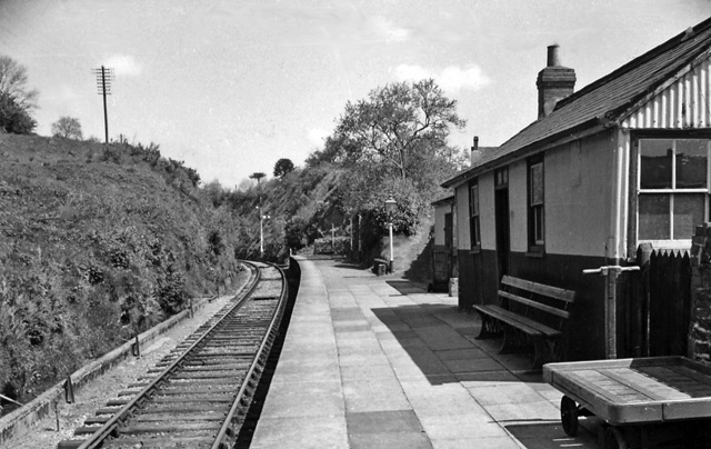
Image: © Ben Brooksbank Taken: 29 Jun 1962
View southward, towards Pencader and Carmarthen; ex-Great Western, Carmarthen - Pencader - Lampeter - Aberystwyth line. The station closed on 22/2/65, when the Carmarthen - Aberystwyth service ceased, but the line remained open Lampeter - Carmarthen, mainly for milk traffic from Felin Fran, until 1973. See also Image
Images are licensed for reuse under creativecommons.org/licenses/by-sa/2.0
Image Location


Leaflet Map data © OpenStreetMap
Latitude
52.028556
Longitude
-4.257967