Ickleford: Turnpike Lane and the Clock House
Introduction
The photograph on this page of Ickleford: Turnpike Lane and the Clock House by Nigel Cox as part of the Geograph project.
The Geograph project started in 2005 with the aim of publishing, organising and preserving representative images for every square kilometre of Great Britain, Ireland and the Isle of Man.

There are currently over 7.5m images from over 14,400 individuals and you can help contribute to the project by visiting https://www.geograph.org.uk
Ickleford: Turnpike Lane and the Clock House
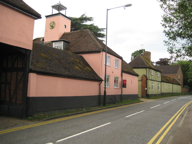
Image: © Nigel Cox Taken: 13 Jun 2010
The Clock House forms part of the stable block to the old Ickleford Manor which burnt down in 1911. The clock is dated 1819 and the clock tower is surmounted by a cupola containing a bell. The building is Grade II Listed. Further up the road the green half-timbered building is Waltham Cottage, another Grade II Listed Building, originally a stable house of the manor.
Images are licensed for reuse under creativecommons.org/licenses/by-sa/2.0
Image Location
Latitude
51.969502
Longitude
-0.280658