Brundall Station
Introduction
The photograph on this page of Brundall Station by Ben Brooksbank as part of the Geograph project.
The Geograph project started in 2005 with the aim of publishing, organising and preserving representative images for every square kilometre of Great Britain, Ireland and the Isle of Man.

There are currently over 7.5m images from over 14,400 individuals and you can help contribute to the project by visiting https://www.geograph.org.uk
Brundall Station
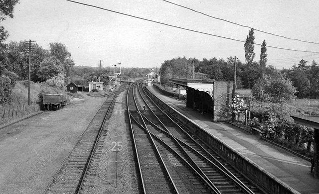
Image: © Ben Brooksbank Taken: 8 Jun 1963
View eastward, ex-Great Eastern Norwich - Yarmouth (Vauxhall) via Acle line to left, to Lowestoft (also Yarmouth) via Reedham to right. The station has staggered platforms, the Up platform being behind camera.
Images are licensed for reuse under creativecommons.org/licenses/by-sa/2.0
Image Location
Latitude
52.619446
Longitude
1.43835