Housing on the Over Estate , Winsford
Introduction
The photograph on this page of Housing on the Over Estate , Winsford by michael ely as part of the Geograph project.
The Geograph project started in 2005 with the aim of publishing, organising and preserving representative images for every square kilometre of Great Britain, Ireland and the Isle of Man.

There are currently over 7.5m images from over 14,400 individuals and you can help contribute to the project by visiting https://www.geograph.org.uk
Housing on the Over Estate , Winsford
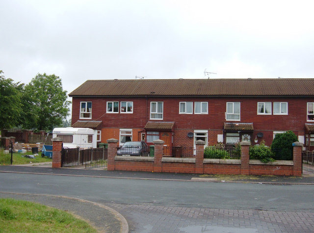
Image: © michael ely Taken: 27 Jun 2006
Local authority housing built to accommodate those displaced by Liverpool's slum clearance programme in the 1960s/70s. This estate received government Estate Action Programme resources in the late 1980s in an attempt to reverse physical and social decline. Brick walls with railings provided what was known then as "defensible space" and add-on porches helped to increase the feeling of security.
Images are licensed for reuse under creativecommons.org/licenses/by-sa/2.0
Image Location
Latitude
53.182644
Longitude
-2.546134