Treborth St, Liverpool
Introduction
The photograph on this page of Treborth St, Liverpool by John Lord as part of the Geograph project.
The Geograph project started in 2005 with the aim of publishing, organising and preserving representative images for every square kilometre of Great Britain, Ireland and the Isle of Man.

There are currently over 7.5m images from over 14,400 individuals and you can help contribute to the project by visiting https://www.geograph.org.uk
Treborth St, Liverpool
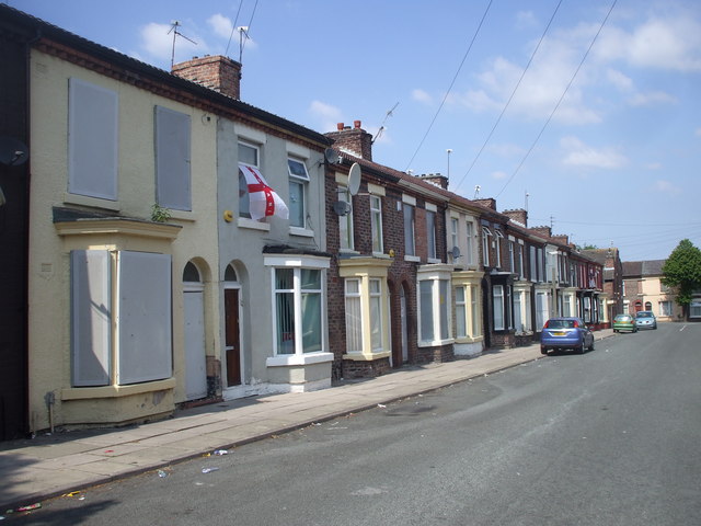
Image: © John Lord Taken: 16 Jun 2010
This is part of the Princes Park Regeneration Zone. In some of the streets, as here, only some of the houses are boarded up. In other streets, all of them are. (The 1:50000 map, perhaps because of difficulties of scale, shows only one short street running SW/NE; there are in fact two, Treborth St and Pengwern St.)
Images are licensed for reuse under creativecommons.org/licenses/by-sa/2.0
Image Location
Latitude
53.387405
Longitude
-2.959978