War Memorial, Main Road, Jacksdale, Nottinghamshire
Introduction
The photograph on this page of War Memorial, Main Road, Jacksdale, Nottinghamshire by Alan Slater as part of the Geograph project.
The Geograph project started in 2005 with the aim of publishing, organising and preserving representative images for every square kilometre of Great Britain, Ireland and the Isle of Man.

There are currently over 7.5m images from over 14,400 individuals and you can help contribute to the project by visiting https://www.geograph.org.uk
War Memorial, Main Road, Jacksdale, Nottinghamshire
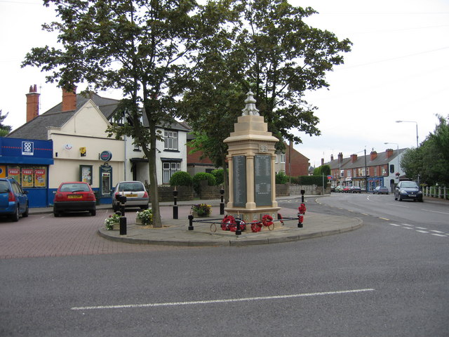
Image: © Alan Slater Taken: 26 Jun 2006
Jacksdale is a former coal mining village situated in the Erewash Valley, on the Nottinghamshire-Derbyshire border. The War Memorial is in the centre of the village, near all the shops and services, at the junction of Wagstaff Lane with Main Road. It is unusual, in that it not only commemorates those from the parish who fell in the Great War of 1914-18 on one panel but also lists all those who served in the armed forces during the same conflict, on the other three panels. The fallen from the Second World War of 1939-45 are commemorated on the smaller panels around its base. Pye Hill pit, the last mine in the area, closed in 1985. A colliery winding wheel across the road from the War Memorial, commemorates the village's strong links with coal mining.
Images are licensed for reuse under creativecommons.org/licenses/by-sa/2.0
Image Location
Latitude
53.059346
Longitude
-1.335977