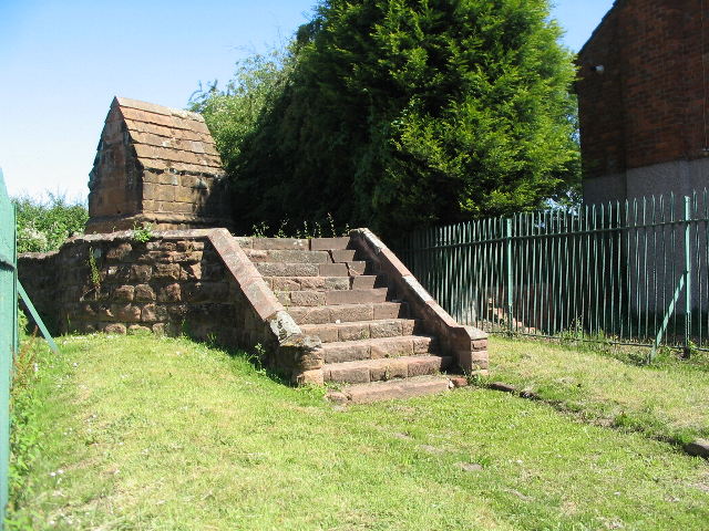
St Catherine's Well, Beaumont Crescent
Introduction
The photograph on this page of St Catherine's Well, Beaumont Crescent by E Gammie as part of the Geograph project.
The Geograph project started in 2005 with the aim of publishing, organising and preserving representative images for every square kilometre of Great Britain, Ireland and the Isle of Man.
There are currently over 7.5m images from over 14,400 individuals and you can help contribute to the project by visiting https://www.geograph.org.uk

Image: © E Gammie Taken: 21 Jun 2010
Out in the countryside until the 20th century, this old conduit head was marked as 'Conduit Springs' on old OS maps. It is now sandwiched between 1920's suburban houses and surrounded by a metal fence. The sandstone building with the steeply pitched roof will have covered the spring head. Before the construction of Spon End waterworks in the mid 19th century the spring provided a water supply via pipe to public conduits in the Spon Street area, one location being Conduit Yard which was situated near St John's church. A grade II listed building, no. 218417

