Site of Conon Bridge station
Introduction
The photograph on this page of Site of Conon Bridge station by Richard Dorrell as part of the Geograph project.
The Geograph project started in 2005 with the aim of publishing, organising and preserving representative images for every square kilometre of Great Britain, Ireland and the Isle of Man.

There are currently over 7.5m images from over 14,400 individuals and you can help contribute to the project by visiting https://www.geograph.org.uk
Site of Conon Bridge station
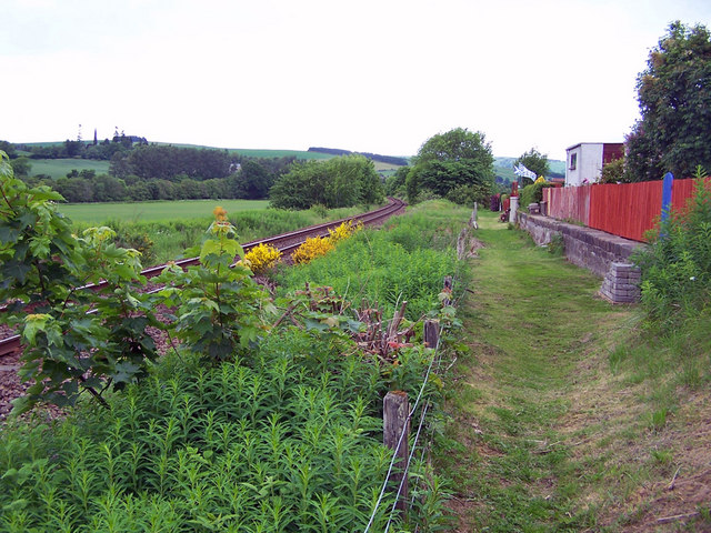
Image: © Richard Dorrell Taken: 20 Jun 2010
The railway is the Inverness to Wick and Thurso line, which opened in 1862. This photograph is taken from the end of Station Road, Conon Bridge. The station here closed in June 1960. What looks to be a former platform is on the right, and is now part of the back gardens of modern houses. If this was a platform - was there once a siding here? (See also Image] ). Update: I have been contacted by Alasdair Cameron, who confirms "Yes, there were several sidings and a large goods shed". Thank you for the information Mr Cameron.
Images are licensed for reuse under creativecommons.org/licenses/by-sa/2.0
Image Location
Latitude
57.561913
Longitude
-4.440333