Tapton Lock
Introduction
The photograph on this page of Tapton Lock by Ashley Dace as part of the Geograph project.
The Geograph project started in 2005 with the aim of publishing, organising and preserving representative images for every square kilometre of Great Britain, Ireland and the Isle of Man.

There are currently over 7.5m images from over 14,400 individuals and you can help contribute to the project by visiting https://www.geograph.org.uk
Tapton Lock
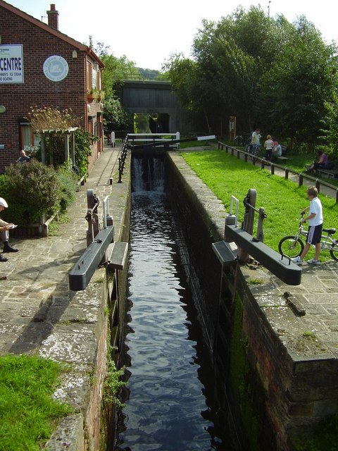
Image: © Ashley Dace Taken: Unknown
A small visitor centre on the left, explaining this part of the Chesterfield canal and the wildlife that can be found in the area. There are also boat rides, the road bridge can be seen in the background.
Images are licensed for reuse under creativecommons.org/licenses/by-sa/2.0
Image Location
Latitude
53.251876
Longitude
-1.419032