Broughton Astley Station
Introduction
The photograph on this page of Broughton Astley Station by Ben Brooksbank as part of the Geograph project.
The Geograph project started in 2005 with the aim of publishing, organising and preserving representative images for every square kilometre of Great Britain, Ireland and the Isle of Man.

There are currently over 7.5m images from over 14,400 individuals and you can help contribute to the project by visiting https://www.geograph.org.uk
Broughton Astley Station
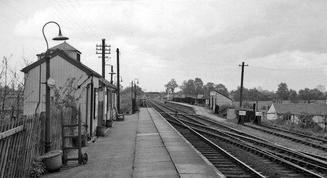
Image: © Ben Brooksbank Taken: 24 Apr 1961
View NE, towards Leicester; ex-Midland Leicester - Rugby line. The line had formerly been a useful route for coal traffic to London (Willesden), but was closed, with this station, completely on 1/1/62.
Images are licensed for reuse under creativecommons.org/licenses/by-sa/2.0
Image Location
Latitude
52.523082
Longitude
-1.213356