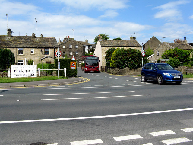
Salterforth Village
Introduction
The photograph on this page of Salterforth Village by Dr Neil Clifton as part of the Geograph project.
The Geograph project started in 2005 with the aim of publishing, organising and preserving representative images for every square kilometre of Great Britain, Ireland and the Isle of Man.
There are currently over 7.5m images from over 14,400 individuals and you can help contribute to the project by visiting https://www.geograph.org.uk

Image: © Dr Neil Clifton Taken: 16 Jun 2010
Salterforth is part of the historic County of Yorkshire, although at present it is in the Borough of Pendle, a Lancashire authority, for local government purposes. Here we are looking across the B6383 (a road that did not exist until 1930) to Chapel Hill opposite, where a bus will shortly emerge and turn right towards its destination of Barnoldswick. From Burnley, the bus has followed a route via Earby and Northolme Estate.

