Horsforth Woodside Bowling Club and Woodside Court
Introduction
The photograph on this page of Horsforth Woodside Bowling Club and Woodside Court by Rich Tea as part of the Geograph project.
The Geograph project started in 2005 with the aim of publishing, organising and preserving representative images for every square kilometre of Great Britain, Ireland and the Isle of Man.

There are currently over 7.5m images from over 14,400 individuals and you can help contribute to the project by visiting https://www.geograph.org.uk
Horsforth Woodside Bowling Club and Woodside Court
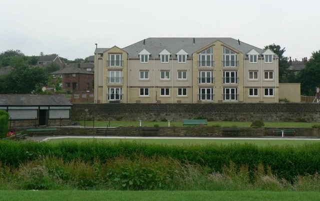
Image: © Rich Tea Taken: 25 Jun 2006
Woodside Court was recently built on the site of a 1960s office block, at the corner of Low Lane and Broadgate Lane. Low Lane is behind the wall at the far side of the bowling green. See also Image] and Image]
Images are licensed for reuse under creativecommons.org/licenses/by-sa/2.0
Image Location


Leaflet Map data © OpenStreetMap
Latitude
53.83747
Longitude
-1.619605