St. Decuman's outer churchyard
Introduction
The photograph on this page of St. Decuman's outer churchyard by Stephen Wilks as part of the Geograph project.
The Geograph project started in 2005 with the aim of publishing, organising and preserving representative images for every square kilometre of Great Britain, Ireland and the Isle of Man.

There are currently over 7.5m images from over 14,400 individuals and you can help contribute to the project by visiting https://www.geograph.org.uk
St. Decuman's outer churchyard
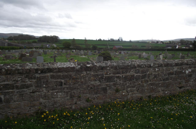
Image: © Stephen Wilks Taken: 1 May 2010
Over the wall from the inner churchyard. The Quantock Hills are skyline left, and the Brendon Hills are skyline right. Parsonage Farm is middle-ground left. The fenced road to the Vicarage runs up the right-hand side of both churchyards. There is then a field separating the churchyard from Watchet Town Cemetery. The red brick building is a shelter for cemetery visitors. The separating field has also been divided to provide a small roadside carpark for the cemetery, running along the B3190 highway between the churchyard and the shelter. The Five Bells area is middle-ground right.
Images are licensed for reuse under creativecommons.org/licenses/by-sa/2.0
Image Location
Latitude
51.175342
Longitude
-3.33747