Gulworthy Cross
Introduction
The photograph on this page of Gulworthy Cross by Tony Atkin as part of the Geograph project.
The Geograph project started in 2005 with the aim of publishing, organising and preserving representative images for every square kilometre of Great Britain, Ireland and the Isle of Man.

There are currently over 7.5m images from over 14,400 individuals and you can help contribute to the project by visiting https://www.geograph.org.uk
Gulworthy Cross
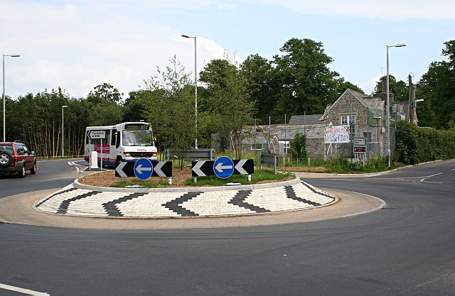
Image: © Tony Atkin Taken: 25 Jun 2006
Most people passing through here will just know this as a roundabout but perhaps don't realise that the roundabout was built, at considerable cost, to replace the previous simple junction due to there being a very bad accident record at this point. Eleven collisions were recorded on the junction in the space of just two years. There is also a school here, a few yards along the road to the right. The proposal document for the roundabout scheme can be read here http://www.devon.gov.uk/loadtrimdocument?url=&filename=ED/04/37/LSO.CMR&rn=10/WD130&dg=Public
Images are licensed for reuse under creativecommons.org/licenses/by-sa/2.0
Image Location


Leaflet Map data © OpenStreetMap
Latitude
50.534043
Longitude
-4.192307