Manchester Ship Canal Railway seen from Merseyton Road bridge
Introduction
The photograph on this page of Manchester Ship Canal Railway seen from Merseyton Road bridge by John Brightley as part of the Geograph project.
The Geograph project started in 2005 with the aim of publishing, organising and preserving representative images for every square kilometre of Great Britain, Ireland and the Isle of Man.

There are currently over 7.5m images from over 14,400 individuals and you can help contribute to the project by visiting https://www.geograph.org.uk
Manchester Ship Canal Railway seen from Merseyton Road bridge
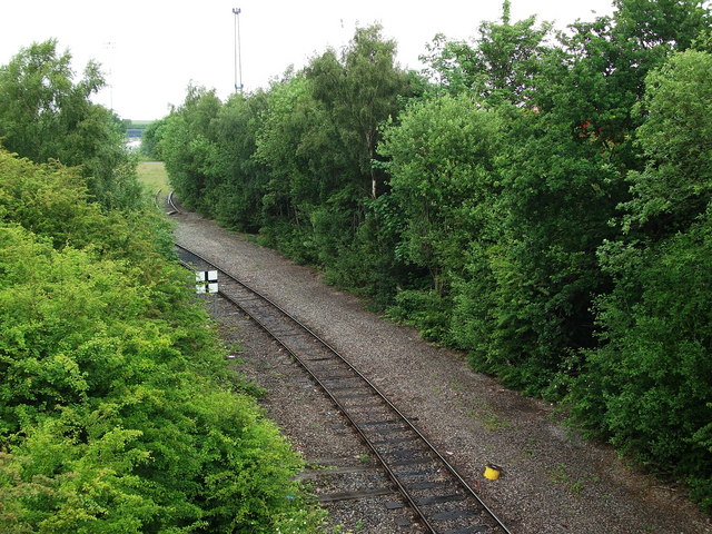
Image: © John Brightley Taken: 13 Jun 2010
This is part of the link between the privately owned dockside railways and the mainline. According to John Eyers website this section was double track until 1996. The now disconnected siding seen bearing right in the background led to Cawoods coal terminal. The line we see here bearing left was reopened in 2005 to Manisty Wharf to handle coal imported to feed Fiddlers Ferry power station.
Images are licensed for reuse under creativecommons.org/licenses/by-sa/2.0
Image Location
Latitude
53.291586
Longitude
-2.90202