Townsend Street, Belfast
Introduction
The photograph on this page of Townsend Street, Belfast by Albert Bridge as part of the Geograph project.
The Geograph project started in 2005 with the aim of publishing, organising and preserving representative images for every square kilometre of Great Britain, Ireland and the Isle of Man.

There are currently over 7.5m images from over 14,400 individuals and you can help contribute to the project by visiting https://www.geograph.org.uk
Townsend Street, Belfast
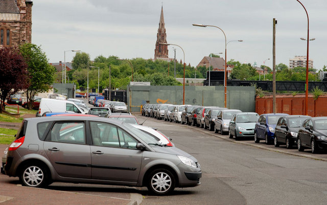
Image: © Albert Bridge Taken: 18 Jun 2010
Townsend Street was a thoroughfare used by combatants during The Troubles/The Armed Struggle. The peace line remains (middle background) but the street has been transformed by the Townsend Enterprise Park (out of picture to the left). The view is towards Peter’s Hill from the Divis Street end.
Images are licensed for reuse under creativecommons.org/licenses/by-sa/2.0
Image Location
Latitude
54.60143
Longitude
-5.93915