Croydon: Disused stairway
Introduction
The photograph on this page of Croydon: Disused stairway by Dr Neil Clifton as part of the Geograph project.
The Geograph project started in 2005 with the aim of publishing, organising and preserving representative images for every square kilometre of Great Britain, Ireland and the Isle of Man.

There are currently over 7.5m images from over 14,400 individuals and you can help contribute to the project by visiting https://www.geograph.org.uk
Croydon: Disused stairway
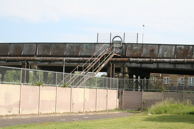
Image: © Dr Neil Clifton Taken: 14 Jun 2010
This stairway which is quite disused and not accessible from either end, can be seen at the 'dead end' northeast end of Towpath Way. At the top of the steps is Tennison Road, as it bridges the railway which lies over to the left. It takes an incredible FIFTEEN MINUTES to walk from where the photographer is standing, to reach Tennison Road at the top of the steps. Just after I had taken this photograph, a youth put his life and limb at risk by climbing the iron fence from Tennison Road, leaping onto the pipe, and thence jumping down onto the waste ground. These steps could easily be reconditioned and brought back into use, allowing residents at this end of Towpath Way to access the Tennison Road shops.
Images are licensed for reuse under creativecommons.org/licenses/by-sa/2.0
Image Location
Latitude
51.392988
Longitude
-0.076253