Stoke Mandeville Combined School
Introduction
The photograph on this page of Stoke Mandeville Combined School by David Hillas as part of the Geograph project.
The Geograph project started in 2005 with the aim of publishing, organising and preserving representative images for every square kilometre of Great Britain, Ireland and the Isle of Man.

There are currently over 7.5m images from over 14,400 individuals and you can help contribute to the project by visiting https://www.geograph.org.uk
Stoke Mandeville Combined School
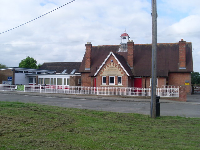
Image: © David Hillas Taken: 12 Jun 2010
Situated in Lower Road off the B4443 road, the former Council School is on the right of the photo, with the extension seen on the left. The school takes children from 4 to 11 years old. Its postcode is HP22 5XA.
Images are licensed for reuse under creativecommons.org/licenses/by-sa/2.0
Image Location
Latitude
51.785803
Longitude
-0.794216