Cleveland and Beetham Towers
Introduction
The photograph on this page of Cleveland and Beetham Towers by Malc McDonald as part of the Geograph project.
The Geograph project started in 2005 with the aim of publishing, organising and preserving representative images for every square kilometre of Great Britain, Ireland and the Isle of Man.

There are currently over 7.5m images from over 14,400 individuals and you can help contribute to the project by visiting https://www.geograph.org.uk
Cleveland and Beetham Towers
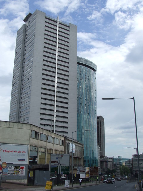
Image: © Malc McDonald Taken: 13 Jun 2010
Cleveland Tower, one of a pair completed in 1971/72, stands at 90 metres high. Behind it is the Beetham Tower, completed in 2005, which is over 120 metres high.
Images are licensed for reuse under creativecommons.org/licenses/by-sa/2.0
Image Location
Latitude
52.47477
Longitude
-1.901464