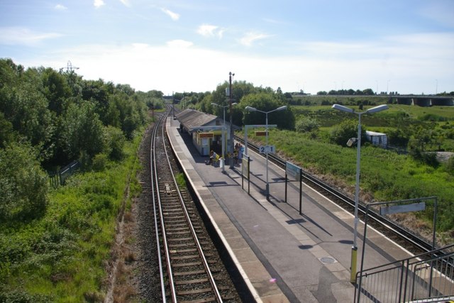
Bidston Station
Introduction
The photograph on this page of Bidston Station by Tiger as part of the Geograph project.
The Geograph project started in 2005 with the aim of publishing, organising and preserving representative images for every square kilometre of Great Britain, Ireland and the Isle of Man.
There are currently over 7.5m images from over 14,400 individuals and you can help contribute to the project by visiting https://www.geograph.org.uk

Image: © Tiger Taken: 12 Jun 2010
Compare with Ben Brooksbank's 1961 photo www.geograph.org.uk/photo/1797460 Merseyrail's Wirral Line still runs straight ahead towards West Kirby, but now passes beneath the M53 motorway which continues along the viaduct to the right, leading to the Kingsway Tunnel. The former Great Central branch to Wrexham (now branded as the Borderlands Line) curves sharply away to the left. The old signal box is gone and there is new platform furniture, but the building on the island platform is recognisably the same. As at other locations on this line, nature, in the form of shrubs and bushes, has encroached almost to the margins of the trackbed and the site of the old LNER sidings is now completely overgrown.

