Hill country near Castlerock (2)
Introduction
The photograph on this page of Hill country near Castlerock (2) by Albert Bridge as part of the Geograph project.
The Geograph project started in 2005 with the aim of publishing, organising and preserving representative images for every square kilometre of Great Britain, Ireland and the Isle of Man.

There are currently over 7.5m images from over 14,400 individuals and you can help contribute to the project by visiting https://www.geograph.org.uk
Hill country near Castlerock (2)
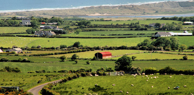
Image: © Albert Bridge Taken: 12 Jun 2010
As Ballyhacket Lane Image climbs towards Altikeeragh it offers views down over the surrounding countryside towards Castlerock. Grazing sheep predominate at lower right. The River Bann (flowing from the right) cuts across just below the top. The Atlantic is at the top and Portstewart Strand is between the two.
Images are licensed for reuse under creativecommons.org/licenses/by-sa/2.0
Image Location
Latitude
55.139552
Longitude
-6.828619