Batford Mill
Introduction
The photograph on this page of Batford Mill by Stan Ames as part of the Geograph project.
The Geograph project started in 2005 with the aim of publishing, organising and preserving representative images for every square kilometre of Great Britain, Ireland and the Isle of Man.

There are currently over 7.5m images from over 14,400 individuals and you can help contribute to the project by visiting https://www.geograph.org.uk
Batford Mill
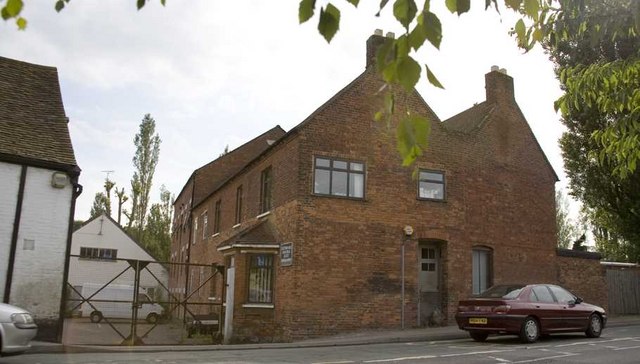
Image: © Stan Ames Taken: 23 Jun 2006
On the B653 at Harpenden, this was once a water mill on the River Lea, it was used for making flour until the mid 20C. The river has been diverted around the building and it is now used as offices.
Images are licensed for reuse under creativecommons.org/licenses/by-sa/2.0
Image Location
Latitude
51.82619
Longitude
-0.325446