
Ramasaig
Introduction
The photograph on this page of Ramasaig by Richard Dorrell as part of the Geograph project.
The Geograph project started in 2005 with the aim of publishing, organising and preserving representative images for every square kilometre of Great Britain, Ireland and the Isle of Man.

There are currently over 7.5m images from over 14,400 individuals and you can help contribute to the project by visiting https://www.geograph.org.uk
Ramasaig
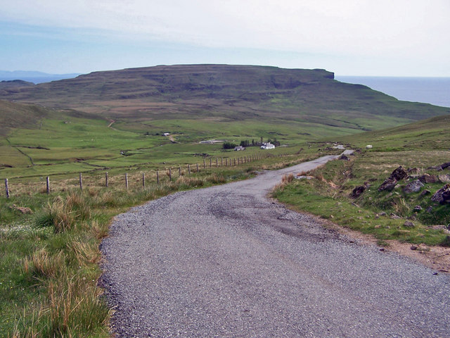
Image: © Richard Dorrell Taken: 10 Jun 2010
Ramasaig lies three miles down a narrow, single track road south of the remote district of Glendale in north west Skye. It certainly qualifies as 'remote'. Today, Ramasaig is one cottage (not permanently occupied), two barns, one cattle pen, and a lot of ruins. The ruins were deserted during the Highland clearances in the 19th century. The track which is just visible leading off to the left, goes to the even more remote and completely deserted township of Lorgill in grid square Image
Images are licensed for reuse under creativecommons.org/licenses/by-sa/2.0
Image Location

Latitude
57.399869
Longitude
-6.721628