Croydon: The 'Orchard'
Introduction
The photograph on this page of Croydon: The 'Orchard' by Dr Neil Clifton as part of the Geograph project.
The Geograph project started in 2005 with the aim of publishing, organising and preserving representative images for every square kilometre of Great Britain, Ireland and the Isle of Man.

There are currently over 7.5m images from over 14,400 individuals and you can help contribute to the project by visiting https://www.geograph.org.uk
Croydon: The 'Orchard'
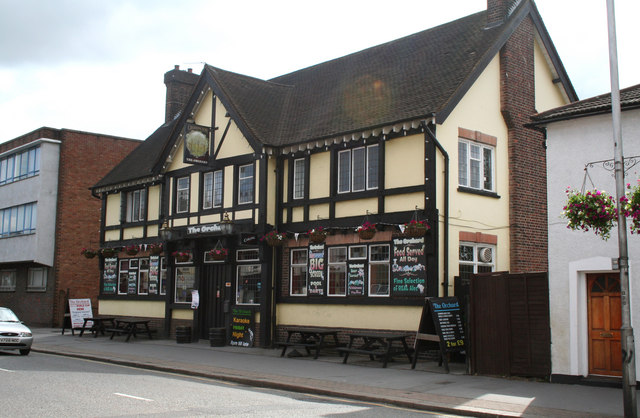
Image: © Dr Neil Clifton Taken: 9 Jun 2010
First opened in 1855 as a beer-house. Until about 1980, the name was the 'Cherry Orchard'. It is a good example of a pub which is making a real creditable effort to stay alive in an area where other pubs have 'gone under': a wide variety of entertainment and activities are offered, and it does give the impression that the landlord really cares.
Images are licensed for reuse under creativecommons.org/licenses/by-sa/2.0
Image Location
Latitude
51.378381
Longitude
-0.090373