Hill Street cycle and foot bridge
Introduction
The photograph on this page of Hill Street cycle and foot bridge by E Gammie as part of the Geograph project.
The Geograph project started in 2005 with the aim of publishing, organising and preserving representative images for every square kilometre of Great Britain, Ireland and the Isle of Man.

There are currently over 7.5m images from over 14,400 individuals and you can help contribute to the project by visiting https://www.geograph.org.uk
Hill Street cycle and foot bridge
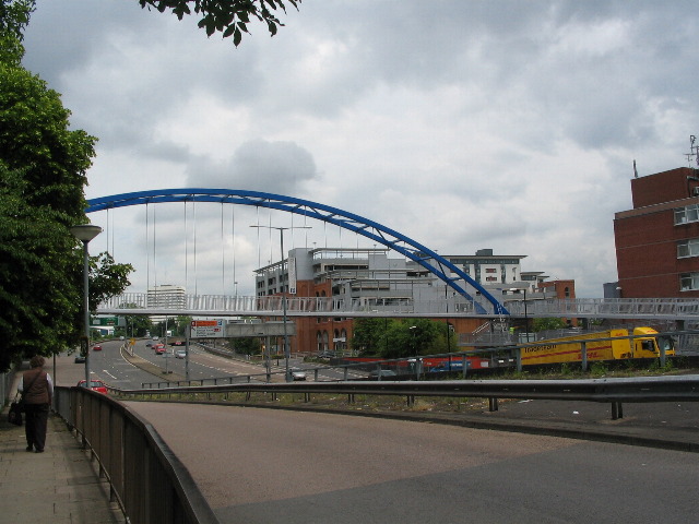
Image: © E Gammie Taken: 9 Jun 2010
The replacement for a dank and dingy subway joining the two parts of Hill Street split by the inner ring road. The bridge was not yet open at the time this photo was taken. To the right of the photographer is junction 8 Holyhead Road sliproad, dropping down to a short gap where you may join the ring road or chicken out and take the junction 9 Radford Road slip road and try again further on. Beyond the bridge on the left is William Batchelor House tower block and, centre, Leigh Mills multi-storey car park.
Images are licensed for reuse under creativecommons.org/licenses/by-sa/2.0
Image Location


Leaflet Map data © OpenStreetMap
Latitude
52.410252
Longitude
-1.518001