Old Island Road Bridge, Barry
Introduction
The photograph on this page of Old Island Road Bridge, Barry by Jaggery as part of the Geograph project.
The Geograph project started in 2005 with the aim of publishing, organising and preserving representative images for every square kilometre of Great Britain, Ireland and the Isle of Man.

There are currently over 7.5m images from over 14,400 individuals and you can help contribute to the project by visiting https://www.geograph.org.uk
Old Island Road Bridge, Barry
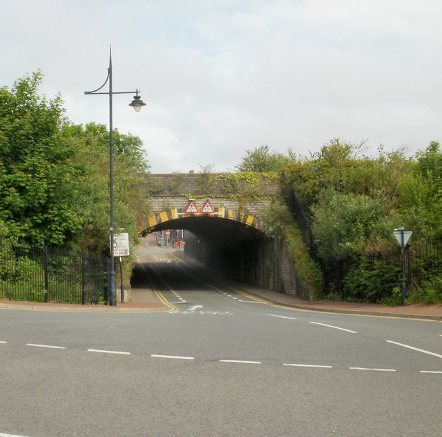
Image: © Jaggery Taken: 6 Jun 2010
Viewed along Powell Duffryn Way, from the corner of Hood Road. The bridge's Railtrack ID is "Old Island Road 7m 78½c BRY". It carries the railway line a little east of Barry Station. Its headroom is 12 feet 9 inches or 3.9 metres, but as it is an arch bridge, the clearance is less on each side of the road. The sign on the left instructs high vehicles to use the middle of the road.
Images are licensed for reuse under creativecommons.org/licenses/by-sa/2.0
Image Location
Latitude
51.39861
Longitude
-3.282161