Bridge on Taff Trail near Llandaff
Introduction
The photograph on this page of Bridge on Taff Trail near Llandaff by Gareth James as part of the Geograph project.
The Geograph project started in 2005 with the aim of publishing, organising and preserving representative images for every square kilometre of Great Britain, Ireland and the Isle of Man.

There are currently over 7.5m images from over 14,400 individuals and you can help contribute to the project by visiting https://www.geograph.org.uk
Bridge on Taff Trail near Llandaff
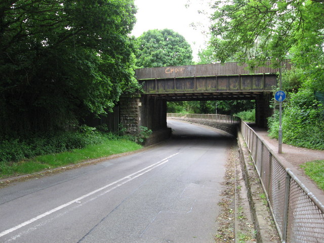
Image: © Gareth James Taken: 7 Jun 2010
The bridge carries the former Taff Vale Railway, as is sited between Llandaff and Radyr. The Taff Trail cycle route passes underneath at the side of the road. Apparently the road used to go under the span on the extreme left (now gated off), and the Glamorganshire Canal passed under where the road is now.
Images are licensed for reuse under creativecommons.org/licenses/by-sa/2.0
Image Location


Leaflet Map data © OpenStreetMap
Latitude
51.509016
Longitude
-3.233383