At the corner of The Square and Oxford Street
Introduction
The photograph on this page of At the corner of The Square and Oxford Street by Gordon Hatton as part of the Geograph project.
The Geograph project started in 2005 with the aim of publishing, organising and preserving representative images for every square kilometre of Great Britain, Ireland and the Isle of Man.

There are currently over 7.5m images from over 14,400 individuals and you can help contribute to the project by visiting https://www.geograph.org.uk
At the corner of The Square and Oxford Street
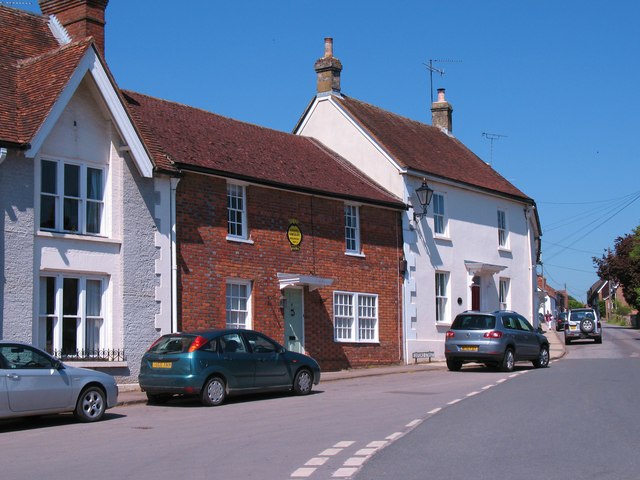
Image: © Gordon Hatton Taken: 3 Jun 2010
Interesting buildings in the centre of Ramsbury. The house with the gable on the extreme left was once the Windsor Castle Inn, becoming a private dwelling in 1958. In the centre is a brick built property displaying an old AA sign. The right hand ground floor windows must have replaced a shop window, as this was a sweetshop in the 1920's. The white house beyond was once the doctors.
Images are licensed for reuse under creativecommons.org/licenses/by-sa/2.0
Image Location


Leaflet Map data © OpenStreetMap
Latitude
51.442635
Longitude
-1.604566