Bridgeton Cross Station
Introduction
The photograph on this page of Bridgeton Cross Station by Ben Brooksbank as part of the Geograph project.
The Geograph project started in 2005 with the aim of publishing, organising and preserving representative images for every square kilometre of Great Britain, Ireland and the Isle of Man.

There are currently over 7.5m images from over 14,400 individuals and you can help contribute to the project by visiting https://www.geograph.org.uk
Bridgeton Cross Station
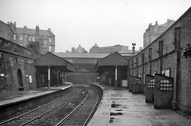
Image: © Ben Brooksbank Taken: 6 Oct 1961
View westward, towards Glasgow Central Low Level. Since 11/1979 called 'Bridgeton'. For further details see Image What a dump!
Images are licensed for reuse under creativecommons.org/licenses/by-sa/2.0
Image Location
Latitude
55.84867
Longitude
-4.226231