Scratchbury Hill
Introduction
The photograph on this page of Scratchbury Hill by Neil Owen as part of the Geograph project.
The Geograph project started in 2005 with the aim of publishing, organising and preserving representative images for every square kilometre of Great Britain, Ireland and the Isle of Man.

There are currently over 7.5m images from over 14,400 individuals and you can help contribute to the project by visiting https://www.geograph.org.uk
Scratchbury Hill
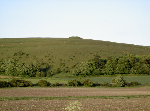
Image: © Neil Owen Taken: 6 Jun 2010
Seen from the B road are the distinctive features of Scratchbury Hill. Along with the ramparts of the hill fort, the barrow is clearly defined. Look closely and you can just make out the marker pole, which alerts the military from digging up the ancient site.
Images are licensed for reuse under creativecommons.org/licenses/by-sa/2.0
Image Location
Latitude
51.197397
Longitude
-2.128039