Telephone Exchange, Oakwood Hill
Introduction
The photograph on this page of Telephone Exchange, Oakwood Hill by David Hillas as part of the Geograph project.
The Geograph project started in 2005 with the aim of publishing, organising and preserving representative images for every square kilometre of Great Britain, Ireland and the Isle of Man.

There are currently over 7.5m images from over 14,400 individuals and you can help contribute to the project by visiting https://www.geograph.org.uk
Telephone Exchange, Oakwood Hill
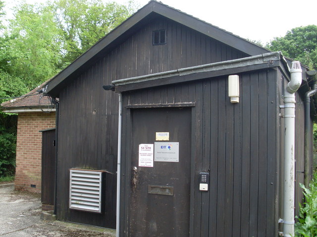
Image: © David Hillas Taken: 5 Jun 2010
Situated down a track, this TE has the code THOL. It provides telephone and broadband services to 583 residential and 73 non-residential premises in the Oakwood Hill and Walliswood rural areas near the Surrey/West Sussex border. The former TE is on the left of the photo, but may no longer be in use. The numbering ranges of this TE are (01306) 627xxx, 628xxx, the (01306) referring to the Dorking group of seven TEs, and its postcode is RH5 5PU.
Images are licensed for reuse under creativecommons.org/licenses/by-sa/2.0
Image Location
Latitude
51.12486
Longitude
-0.3818