Old road sign, Rugby Road, Bulkington
Introduction
The photograph on this page of Old road sign, Rugby Road, Bulkington by John Brightley as part of the Geograph project.
The Geograph project started in 2005 with the aim of publishing, organising and preserving representative images for every square kilometre of Great Britain, Ireland and the Isle of Man.

There are currently over 7.5m images from over 14,400 individuals and you can help contribute to the project by visiting https://www.geograph.org.uk
Old road sign, Rugby Road, Bulkington
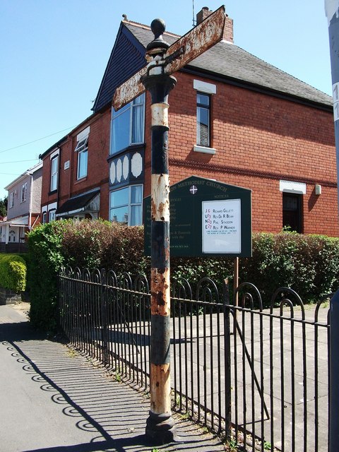
Image: © John Brightley Taken: 3 Jun 2010
The remains of a road sign outside Ryton Methodist Church which I can only guess dates from the 1930's - it is certainly 'pre-Worboys', i.e. pre-1964. It is certainly a rare survival in Warwickshire - probably one of the oldest in the county. For context see Ian Rob's photo Image For detail photos see Image]and Image]
Images are licensed for reuse under creativecommons.org/licenses/by-sa/2.0
Image Location
Latitude
52.475985
Longitude
-1.417374