Guisborough 12
Introduction
The photograph on this page of Guisborough 12 by Keith Evans as part of the Geograph project.
The Geograph project started in 2005 with the aim of publishing, organising and preserving representative images for every square kilometre of Great Britain, Ireland and the Isle of Man.

There are currently over 7.5m images from over 14,400 individuals and you can help contribute to the project by visiting https://www.geograph.org.uk
Guisborough 12
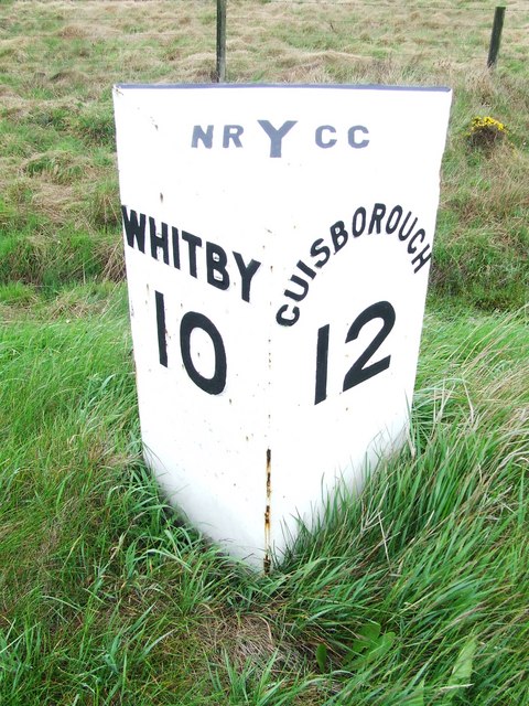
Image: © Keith Evans Taken: 30 May 2010
Old mile post on the A.171 near to Scaling, North Yorkshire. For overall view see http://www.geograph.org.uk/photo/1897968
Images are licensed for reuse under creativecommons.org/licenses/by-sa/2.0
Image Location
Latitude
54.505399
Longitude
-0.812539