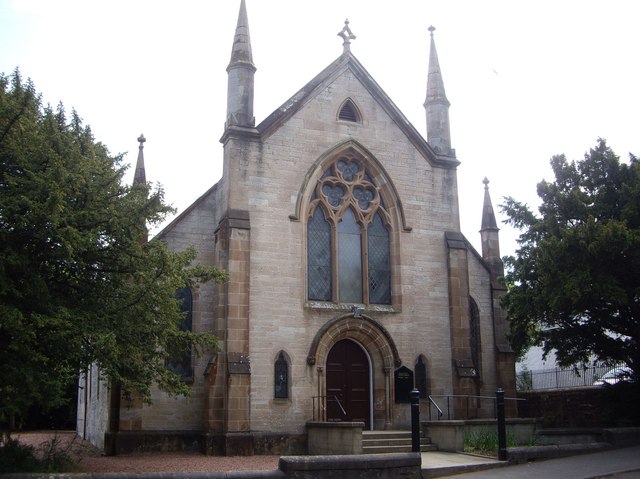
Carswell Halls
Introduction
The photograph on this page of Carswell Halls by Kenneth Mallard as part of the Geograph project.
The Geograph project started in 2005 with the aim of publishing, organising and preserving representative images for every square kilometre of Great Britain, Ireland and the Isle of Man.
There are currently over 7.5m images from over 14,400 individuals and you can help contribute to the project by visiting https://www.geograph.org.uk

Image: © Kenneth Mallard Taken: 4 Jun 2010
Carswell Church was built around 1861. The building was formerly the Carswell United Presbyterian Church (the United Presbyterian Church was formed in 1847 following the union between the Secession Church and the Relief Church) before it merged in 1900 with the Free Kirk who had their church in what is the present church halls in Montgomery Street opposite Mid Road. In 1929, the united congregations became the Carswell Church of Scotland before finally merging with the Parish Church to form the present Eaglesham Parish Church. The church is now the Carswell Halls and takes its name after the Rev. William Carswell who was ordained in 1827. Click on these links to discover about the churches http://www.geograph.org.uk/photo/1424798 http://www.geograph.org.uk/photo/2385541 http://www.geograph.org.uk/photo/2385555.

