Site of Bridgefoot Station
Introduction
The photograph on this page of Site of Bridgefoot Station by Ben Brooksbank as part of the Geograph project.
The Geograph project started in 2005 with the aim of publishing, organising and preserving representative images for every square kilometre of Great Britain, Ireland and the Isle of Man.

There are currently over 7.5m images from over 14,400 individuals and you can help contribute to the project by visiting https://www.geograph.org.uk
Site of Bridgefoot Station
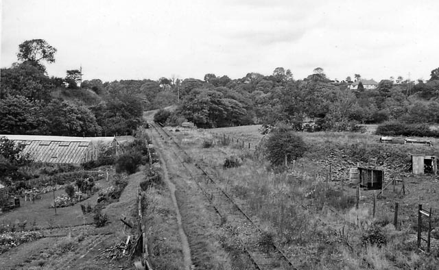
Image: © Ben Brooksbank Taken: 25 Sep 1961
View northward, towards Marron West Jct., Camerton (and Workington); ex-LNW & Furness Joint Marron West Jct. - Ullock - Cleator Moor line. Passenger trains ceased and station closed back on 13/4/31, but remained open for goods until line closed completely (Marron Jct. - Rowrah) on 3/5/54; the remainder of the line lasted a few years longer.
Images are licensed for reuse under creativecommons.org/licenses/by-sa/2.0
Image Location
Latitude
54.650501
Longitude
-3.462238